Mount Kilimanjaro Rongai Route to the rooftop of Africa, Uhuru peak!!! A sight to behold, There is more to this mountain than the height and the ultimate point itself. Am talking about the 8 days life-changing climb to Uhuru Peak standing at an impressive 5895M above sea level, at first it’s the rain forest, then the moorland, the alpine desert and finally the blinding cotton wool like snow coated peak if you are lucky. A dormant volcano, Kilimanjaro is notable as the highest free-standing mountain in the world, rising over 16,000 feet above its base on the plateau below, and also as the fourth most topographically prominent peak on Earth, after Everest, Aconcagua, and Denali.
Here is a brief itinerary
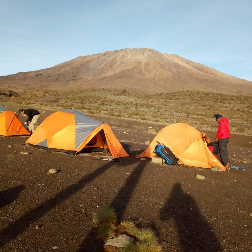
Mount Kilimanjaro Rongai Route is on the Northern side of Mount Kilimanjaro and because of its remote access location, the route offers a relatively un-spoilt wilderness experience. It is a road less traveled where there is a possibility of seeing large wildlife like antelope, elephants, and buffalos. The North-East side of the mountain gets significantly less moisture than the southern slopes which means that trekkers are less likely to encounter rain. We are also more likely to get clear, unclouded views of the mountain all the way from day one.
The Rongai Route is a gentle trail compared to all the other routes, a constant gentle up allowing adequate acclimatization, especially at Mawenzi Ridge. The trail is one of the easiest routes up Kilimanjaro, once at the top, we shall descend via the Marangu trail.
Day 1: Nairobi – Oloitoktok – Rongai Gate – Simba Camp
Hiking: 4-5 hours
Overnight Altitude: ~2671m asl
Distance: 6.5km
Day 2: Simba Camp – Second Cave Camp
Hiking: 3-4 hours
Overnight Altitude: ~3450m asl. Distance: 6km
Day 3: Second Cave Camp – Third Cave Camp
Hiking: 3-4 hours
Overnight Altitude: ~3930m Distance: 5km
Day 4: Third Cave – Kibo Huts
Hiking: 4-6 hours
Overnight Altitude: ~4720m asl Distance: 5.8km
Day 5: Kibo Huts – Gilman’s Point – Uhuru Peak – Horombo Huts
Hiking: 16hours
Overnight Altitude: ~3720m asl Distance: 15km
Day 6: Horombo Huts – Marangu Gate – Moshi
Hiking: 5-7 hours
Overnight Altitude: ~1800m asl Distance: 20km
Day 7:
Travel back home from Kilimanjaro Airport or Bus Shuttle from Moshi to Nairobi
Visa Application
For EA Citizens- you will only need your passport or temporary travel paper issued by the Immigration Department. For Non-EA kindly apply for your Tanzanian visa at least 10 days working before the trip. Here is the link https://visa.immigration.go.tz/start
(https://www.xe.com/currencyconverter/convert/?Amount=1&From=USD&To=TZS ) you can monitor here the exchange rate here. Always change money at the authorized dealers
Water on the trail
You will usually source from the streams on the trail, kindly carry some water purifier tablets if you have a sensitive stomach- highly recommended
Tips
There is a tipping culture here in Kilimanjaro and there is an expectation from the guides to the porters to get a tip from the climber. You recommend $15 per day for the guide; $12 for the chef; and $5-$8 for each porter. The final decision on how much to tip is up to you and depends on the services you received.
High Altitude Sickness
If you are coming from low altitude- or not well acclimatized – despite Rongai being a gradual and most recommended route for those coming from low altitudes. You may also need to carry Diamox(it may have a different name in your country) – a medication that helps with reducing the effects of high altitude. NB: Ask your physician to prescribe the dosage.